


Report calls for review of railway Green Belt in Manchester
An estimated 26,000 acres around railway stations in Greater Manchester could be developed if there was “modest reform to the Green Belt”, according to Centre for Cities.
The think tank’s “Where can we build new homes” report argues that Green Belt reform would allow more than two million homes to be built within 45 minutes by rail to major UK city centres.
To compile its report, Centre for Cities excluded all Green Belt land classed as sites of special scientific interest, areas of outstanding beauty, national parks and other sites of special value. It also excluded all commuter stations inside urban Green Belt boundaries by more than 800 metres.
“For each commuter station, there is a total area for land within 800 metres which is currently classified as arable or horticulture, woodland, or grassland that is not otherwise protected,” the report said.
The areas in Greater Manchester, or adjacent to the City Region with connectivity to Manchester, with the highest potential for such development are:
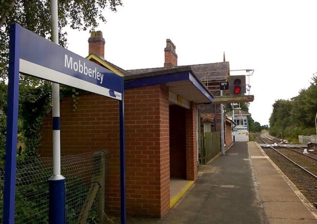
- Mobberly: 455 acres in total, with 54-acres on arable and horticultural land, 353-acres on grasslands, and 48-acres on woodland
- Ashley: 447 acres in, with 247-acres on arable and horticultural land, 185-acres on grasslands, and 16-acres on woodland
- Goostrey: 445 acres in total, with 216-acres on arable and horticultural land, 219-acres on grasslands, and 10-acres on woodland
- Adlington, Cheshire: 442 acres in total, with 17-acres on arable and horticultural land, 333-acres on grasslands, and 92-acres on woodland
- Strines: 440 acres in total, with 3-acres on arable and horticultural land, 334-acres on grasslands, and 103-acres on woodland
- Acton Bridge: 400 acres in total, with 106-acres on arable and horticultural land, 319-acres on grasslands, and 15-acres on woodland
The six areas with no potential for Green Belt release are Burnage, Burton Road, Crumpsall, Failsworth, Humphrey Park and Oldham Mumps.
Andrew Carter, chief executive of Centre for Cities, said: “We often talk about the need to build 300,000 new homes a year to tackle the housing crisis. But less often do we talk about where in the country these homes need to be built to make a difference.
“Housing provision should follow where people need to live for work. This means building in and around larger cities with lots of jobs. Using existing commuter infrastructure as base to deliver accessible new homes near our biggest cities could be the simplest way to do this; but it will require political will and compromise on the Green Belt.”
The North West has seen a loss in designated Green Belt land of 3,410 acres over the past year, according to the Government’s latest Green Belt report.
The majority of losses came from a combined area of Manchester, Liverpool and West Yorkshire, which lost a total of 3,237 acres between the 2017/18 and 2018/19 financial years. This represented the second largest loss in the area in the past decade, after Green Belt land across those areas shrunk by 11,787 acres between 2016 and 2017.
Green Belt land is intended to check unrestricted sprawl of large, built-up areas, protect the countryside, and aid urban regeneration by prioritising development on brownfield sites, among other aims. “The Government attaches great importance to Green Belts,” the Local Planning Authority Green Belt: England 2018/19 report, published in October, said.
“The fundamental aim of Green Belt policy is to prevent urban sprawl by keeping land permanently open.”
However, the pressure of delivering housing targets has prompted some local authorities to review their Green Belt sites and include them in development plans.
Centre for Cities’ Carter said: “So far, politicians from all parties have been reluctant to address [this controversial issue] through planning reform and this reluctance stands as the biggest barrier to change.”
“If these new homes are delivered close to where they are needed near big cities then they will have access to workers to grow their economies and raise local productivity. But if we continue to stall on this, then our biggest cities, and the millions of people living in them, will soon pay a big economic price.”
To access the report, click here.
How nice that London-based Centre for Cities should be lecturing us on such examples of ‘modest reform’ here in the North.
By LEighteen
What a great idea for using all that surplus capacity on our rail network.! (If only!)
By Unconvinced
Sounds like a good idea to me.
By Active Travel Trev
They’re absolutely right though. The only way Greater Manchester can begin to meet its housing needs or fulfill its economic potential is through large scale Green Belt release. Very obviously, the places to start are where there is sustainable transport connectivity.
By Anonymous
Hurry up and get on with it. This is very sensible. I’d add Chelford and Prestbury to that list too
By About time
Acton Bridge, only 1 hour and 22 minutes from Manchester Piccadilly (change at Crewe). Doesn’t exactly sound like a commuters dream! Can only assume these results were obtained by use of algorithms with zero common sense applied.
By UnaPlanner
This isn’t lecturing it’s a piece of analysis and research and a useful one at that.
By Housey
I’ve had a look at the report seems and the general principle seems sound, although the methodology is a bit crude. Most of the land identified may not really be developable, and they don’t take account of distance from Manchester or service frequency. However even if some of it could be developed along compact city lines (not, for instance like the recent dreadful,wasteful low-density houses next to Strines Station), then we probably wouldn’t need any Green Belt release remote from decent public transport. BTW, I’m not sure that CIC being based in London is relevant to anything
By Peter Black
I am really struggling to identify the 11 hectares of ‘buildable’ grassland that are located within 800m of Hale station….
By JR67
It is an interesting idea to lead with location which has sustainable transport links. So many of the comments on here regarding housing developments focus on congestion so this seems to be something that could inform policy for preferred development sites.
By Bradford
People who live in all of these places are happy as it is, they do not want more homes taking up space
By PDM
This isn’t a new idea and the general principles of sustainability are applied to most strategic planning. Its an interesting report although as suggested the methodology is limited and involves algorithms based on what data is entered. Goostrey had recent appeals fail due to potential interference with Jodrell Bank and the same would apply at Mobberley in addition to the potential for issues from the Airport,Ashley with HS2 etc?
By taxed
What should be factored in to any s106/CIL contribution from the developers is the need to make decent segregated cycle/pedestrian access from the developments to the stations (and cycle storage at the stations). Without this, many of the village developments would only be accessible via unsafe rural lanes – which will simply encourage more car use. No doubt though that they would then argue that this, together with any demand for ‘affordable’ housing would make the schemes unviable.
By Squiggle
I agree with Peter Black. Londoners have transport options on every street.It takes half an hour from the depths of Kent to get to the West End. Last time I looked there wasn’t a tube train every three minutes from Goostrey to Piccadilly.These people should have no say in what is right for us, until they give up some of the infrastructure spending they are gifted every year.That billion pounds spent on fancy shops at London Bridge station would have gone a long way to redressing the balance.
By Elephant
Goostrey won’t work – it is right next to Jodrell Bank
By Anonymous
Agree with Elephants comments. Also since when is goostrey 45mins on train to mcr? Strines is around 34mins to mcr which is the exact time it takes between st Pancras and Ashford in Kent some four times the distance. If anything it just reinforces the need to fix the broken transport/rail infrastructure we have in this region. Oh, and I suspect no developer in their right mind will want to build in the strines area after what nearly happened this summer up at Whaley..
By Adam Ash
Do not do it.
By Simpson
How about reinstating the closed railway stations in GM first?
By Acelius
The very idea of rural “land grabbing” along rail routes to transform relatively small communities into an urban sprawl is planning gone mad, and it is obvious the so-called “Think Tank” in this report has not done its homework, for example, Mobberley development would be constrained by Manchester Airport and in the case of Goostrey, the area indicated would fall within the Jodrell Bank radio telescope exclusion zone for development. What they suggest is not without precedent and was the result in the late 19th and early 20th centuries of uncontrolled growth of what is now Greater London where villages and small towns on rail routes from the Capital became overwhelmed and submerged into one enormous mass we see today. .
By John Williams