


Region’s Green Belt shrinks by 3,400 acres
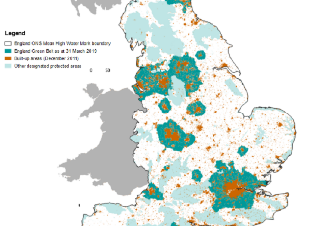
The North West has seen a loss in designated Green Belt land of 3,410 acres over the past year, according to the Government’s latest Green Belt report.
The majority of losses came from a combined area of Manchester, Liverpool, and West Yorkshire, which lost 3,237 acres between the 2017/18 and 2018/19 financial years, the second largest loss in the area in the past decade, following a loss of 11,787 acres between 2016 and 2017.
Liverpool, Manchester and West Yorkshire, which had 1.24m acres of Green Belt in 2013, now has 1.22m as of 2019. The area lost approximately 250 acres a year between 2013 and 2016. However, there was a rapid decline between 2016 and 2018 as the area lost 10,000 acres of Green Belt.
Elsewhere in the North West, Burnley, Fylde and Wyre authorities in Lancashire have all also seen a decrease, after adopting new boundaries for the designated Green Belt between 2018 and 2019. Burnley had 2,620 acres in 2018 and now has 2,594 in 2019, and Wyre had 750 in 2018 and now has 680 in 2019. Together, this amounts to an overall loss of 177 acres.
Burnley’s Local Plan was adopted on 31 July 2018, including a Green Belt review. It recommended that a number of parcels be removed from the Green Belt; one of these, a former school, had outline planning permission for redevelopment.
The Wyre Green Belt study, which was published in 2016, recommended that three parcels of land were considered for removal. This included Cardinal Allen School Grounds in Fleetwood, land south of Blackpool Road in Poulton-le-Fylde, and land in Poulton. The Local Plan was adopted by the Council in February this year.
In nearby Fylde, the council’s adoption of its Local Plan enabled a minor gain in Green Belt land; boundaries have been redrafted around a previously developed holiday camp which is now being developed for housing. The borough had 1,770 acres of Green Belt land in 2017 and now has 1,780 acres.
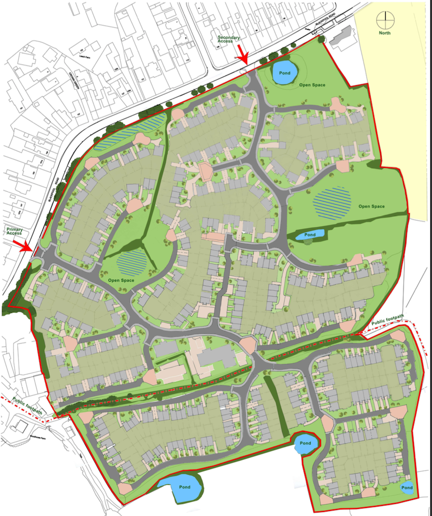
Proposals have already been submitted to Wyre Council for the plot of Green Belt land released earlier this year
Blackpool, which did not see any loss of Green Belt between 2013 and 2017, has lost 198 acres between 2017 and 2019. This is a difference from 6,424 acres in 2013 to 6,227 in 2019.
Between 2018 and 2019, there was a reported decrease of 8,130 acres in England, which is the second largest decrease reported in the past decade following the changes recorded last year. This represents a 0.2% loss of overall Green Belt.
The number of Local Authorities making changes designated Green Belt land has also increased in the past decade, but particularly from 2014 onwards.
In 2017 to 2018, 2% of residential addresses were created on the Green Belt, which is a decrease from 4% recorded between 2016 and 2017. Around 8% of all land changing to residential use was on the Green Belt, which is a decrease from 10% recorded between 2016 and 2017.
However, between 2017 and 2018, 53% of residential addresses created within the Green Belt were built on previously developed land, a 51% increase compared to figures recorded between 2016 and 2017. Around 7% of England’s total Green Belt is developed with 93% remaining non-developed.
Residential use accounts for 0.3% of the Green Belt.
The report, published by the Ministry Housing, Communities & Local Government show there is just over four million acres of land designated as Green Belt, which represents 12.4% of the total land area of England. The tables cover Green Belt allocation since 2013.
Related Articles
Analysis - Commentary
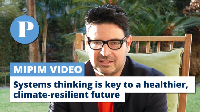
MIPIM VIDEO | Why systems thinking is key to a healthier, climate-resilient future
Civic Engineers chief executive Stephen O’Malley discussed at the global property conference how holistically exploring the interaction of different networks can help the cities of tomorrow to stand the test of time.
Any stats on the available brownfield? If this has also grown in any area, green belt building should be categorically off the menu.
I observe a lot of applications going in where nothing gets built. Surface car parks going in where buildings are supposed to sit, or just empty rubble land left behind.
Short term profit making cannot be allowed to continue holding the economies of entire cities (city) hostage.
By Mike
https://www.gov.uk/guidance/brownfield-land-registers
By G00gle
Very few brownfield sites within Wyre, effectively leaving much of its greenfield and green belt at the mercy of a ridiculously inflated OAHN figure.
By Trent Steele
As mentioned in the article 53% of new homes built the Green Belt were built on previously developed land, i.e. brownfield land. A brownfield first approach to the delivery of new housing does not necessarily mean it won’t be in the Green Belt.
By NWPlanner
In reality a large proportion of the land removed from the greenbelt will be classed as safeguarded. As such it’s not a free for all like post people believe and the bulk of this safeguarded land is set aside for housing provision over the next decade or so.
By Anonymous
Actually Blackpool has not lost any Green Belt in the last 2 years. There are only 70 hectares (173 acres) of Green Belt in Blackpool Borough. I think Chloë was looking at Table 3 (longer term changes) in the MHCLG report, which lists the trends for ‘urban cores’. I presume in this case the Blackpool Urban Core also includes Fylde and parts of Wyre boroughs.
By David Insight
Enough building on our fields now Wyre planners. Too much already. Please don’t let your local population down.
By Anonymous