


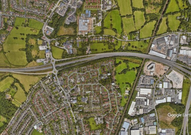
A Manchester Airport relief road c Google Earth

The A555 is a key east-west route for Sotkcport, north Cheshire and South Manchester. Credit: Google Earth

Stockport looks to tackle A555 flooding woes

Further actions to reduce the risk of flooding on the link road to Manchester Airport, a headache since the dual carriageway’s 2018 completion, have been presented to local councillors.

The 13km Manchester Airport eastern link road road links the A6 to the motorway network around Manchester Airport.

Long seen as crucial to improving infrastructure for Stockport, south Manchester and north Cheshire, the completion of the A555 beyond the 1995-delivered section between Handforth and Bramhall was adopted as transport policy in 2001, but it took a further 17 years for the relief road to be fully completed.

This saw Carillion and Morgan Sindall deliver the sections at each end to complete the project.

As set out in a report considered by Stockport Council’s Bramhall and Cheadle Hulme South area sub-committee this week, lower sections of the route have in recent years experienced flooding during periods of prolonged and intense rainfall, with issues including the highway drainage system and pumping infrastructure.

The route was affected during floods in July 2019, subsequently being included within Stockport Council’s Section 19 Flood Investigation Report, an investigation that identified several contributing factors including exceedance of attenuation pond storage, limitations in pump station capacity, and pressure on the wider drainage network during extreme rainfall events.

Stockport then commissioned works including drainage reviews, improvements to pumping infrastructure, cleansing of storage tanks and drainage infrastructure, inspection and maintenance of receiving watercourses and developing further drainage.

The report said that while these measures had “improved operational resilience,” parts of the A555 remain vulnerable during extreme weather events, as was seen with flooding over New Years Eve 2024, when the River Mersey at Brinksway, Lady Brook at Bramhall Green and Poise Brook all recorded record water levels.

With freezing weather following the storms, this flood event closed the A555 for a time, the stretch of road to the north of Handforth being particularly badly afflicted.

Specific measures taken since include the completion in July of a drainage diversion at Woodford Recreation Ground, diverting drainage from the Highfield Parkway housing estate and Woodford Rec to the north of the A555, which previously discharged into the A555 drainage system upstream of the existing Hall Moss Lane pump station, creating additional load.

This drainage has been returned to its original route into Spath Brook to the north side of the A555, which has the capacity to take on the load according to the council team’s hydraulic modelling.

The next stage, Stockport said, is increasing the overall pump capacity at Hall Moss Lane, with work planned to start later this year. Works to help prevent the station being overwhelmed include replacement of existing equipment and increasing pumping capacity to improve the rate at which water can be removed from the drainage system during extreme weather events.

In the coming year, the report added, the council will look at improvements to the pond capacity at the Oil terminal gyratory pond. Following the downstream improvements at the Hall Moss Lane pump station, it is proposed to increase the discharge rate from the ponds.

The thinking is that an increase in discharge rate will reduce the drain-down time and allow for more flow to reach the pumping station outside of critical storm events, mitigating the issue of the pond overtopping during periods of prolonged and heavy rainfall.

  • This story has been updated to provide further information on the timeline of the A555’s delivery


Your Comments

Read our comments policy

Now it is fair to say that developers get a hard time when it comes to drainage related matters in Stockport. Yet when the Council has a leadership role in the delivery of this critical and expensive piece of infrastructure nobody seems to marked their “homework”.

Now everyone has to suffer the inconvenience of the problem created by the Council and the ratepayers the cost of fixing the problem (which would have been a lot cheaper if designed in from the outset).

By Anonymous

This section of road did not open in 2018 – it was opened in 1995. More recently, in 2018, new sections of the A555 were opened which connected it at either end (to the airport in one direction and the A6 at Hazel Grove in the other).

The 1995 road was built by Cheshire County Council. The problems being experienced are a consequence of the original design not having adequate regard to the increased flood risk arising from climate change. This is a legacy issue which Stockport Council are now having to resolve since taking over responsibility for the road when its extended length opened in 2018.

Accuracy of reporting matters.

By Anonymous

It’s an interesting one this for a couple of reasons. The section of road that has seen flooding was completed in 1995. Between 1995 and completion of the A555 tie-in section I had known it to flood once when the pumping station broke. So what changed? As now alluded to it does look like the cycle path installed to the north of the existing road covered the existing drainage to Spath Brook allowing run-off to short cut down the embankment and into the drainage system just above the underpass. As a regular user of the cycle path I know that the run-off was very substantial during periods of heavy rain. Indeed, the recent work has basically replaced the whole cycle path up to Spath Brook.

So, how did this happen? Did the original A555 cycle path plans include drainage to divert run-off into Spath Brook? Did the road builders ignore said plans? Answers on a postcard (and presumably not any sort of inquiry).

The other interesting part to this of course is that the fields from which there is substantive run-off are now subject to planning permission for a new housing development, which would surely alleviate the surface water issue anyway. Timing is everything.

By Bramhall Resident

Too many folk go to “Uni”. That is why too many folk do not know how to make things, how to do things. Only the “toffs”, who never ever made or did anything, went to “uni”. The Industrial Revolution was not made by “uni” graduates.

By Anonymous

So my experience of Stockport Highways complaining that I wouldn’t certify a 2010 budget for a four year life against RICS rules is not indicative of cheeseparing is it????

By Old and Cynical

Did the company building the A555 not do drilling tests for the ground capacity to absorb water and even insert drainage channels ? Go to a clairvoyant and ask if you can contact a Victorian engineer. At least they knew what they were doing!

By Rebecca Robinson

Nice to see some of my friends wandering in from Twitter to comment on this one.

By Reactionary

About time. The company who built this should be paying for the work. I know one of them went bump mid-way through the build, but Morgan Sindall are still going and seem to have gotten away Scot-free with any of the remedial work. I don’t really care if it was there plan or not, they delivered something that doesn’t work, and they should have known that and said. Now they might have done, and the council said build it anyway, but then that’s another convo and it’s almost certainly a LibDem council that signed that one off back in the day. Hence the TH’s desire to make taxpayers foot the bill. Questions and no answers.

By Andy P

Related Articles

Sign up to receive the Place Daily Briefing

Join more than 13,000+ property professionals and receive your free daily round-up of built environment news direct to your inbox

Subscribe

Join more than 13,000+ property professionals and sign up to receive your free daily round-up of built environment news direct to your inbox.

By subscribing, you are agreeing to our Terms & Conditions and Privacy Policy.