


Rochdale maps out railway station masterplan
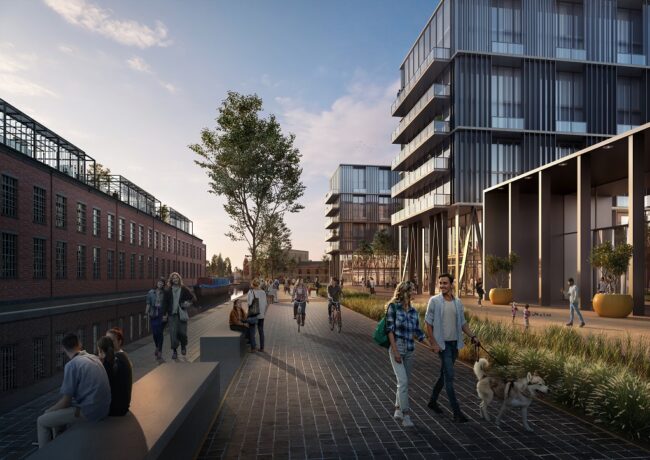
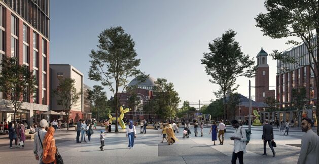
The council has drawn up plans to redevelop land around its five stations to create 7,000 homes, 2.5m sq ft of commercial space and an £11m cycle corridor to increase connectivity and boost the local economy.
Under the masterplan, announced last October and drawn up over the past few months by urban planners at Broadway Malyan and WSP, brownfield land around Rochdale, Castleton, Smithy Bridge, Littleborough and Mills Hill stations would undergo major redevelopment in the borough’s biggest regeneration in decades.
In total, the masterplan proposes more than 7,000 homes and 2.5m sq ft of employment space along the Calder Valley rail corridor, including:
- 1,500 new homes around Rochdale station, catering for 3,500 people
- 43,000 sq ft of new retail and commercial space around Rochdale station
- 26,000 sq ft of offices or managed workspace around Rochdale station
- A new public square at Rochdale station
- 1,500 new homes around Castleton station
- The extension of the Manchester Metrolink to Bury and Heywood via Castleton
- An £11m cycle corridor connecting Castleton to Rochdale
The plans also include development around a potential sixth railway station in the borough, which would be Slattocks in Middleton, proposals for which form part of Transport for Greater Manchester’s 2040 strategy.
Rochdale Station entrance would be overhauled with homes and offices
The regeneration masterplan is being delivered by Rochdale Borough Council in collaboration with the newly formed Greater Manchester Station Alliance, a partnership of Network Rail, Northern Rail, Transport for Greater Manchester, transport regeneration body LCR and the Greater Manchester Combined Authority.
Rochdale is to be the first GM borough to benefit from the alliance’s work, although the group is working with other local councils to identify regeneration opportunities around rail stations.
Rochdale’s stations are viewed as prime sites for economic development, with 2.7 million journeys made from them in 2019, according to the council.
Cllr John Blundell, Rochdale’s cabinet member for economy, business and skills, said: “The land around our railway stations has huge potential for regeneration because you’re putting people close to the transport connections and local facilities that you need to create sustainable neighbourhoods.
“Rochdale’s incredible connectivity, with five railway stations, and a sixth on the cards, puts us in unrivalled position to repurpose brownfield sites along the Calder valley corridor to unlock thousands of new homes a stone’s throw from Manchester city centre, for a fraction of the price.”
“Through targeted investment and collaboration across the public and private sectors, there are many further regeneration opportunities we can unlock to support new homes, jobs and public value in town centres across the city region,” added James Howard, development manager at LCR.
Broadway Malyan and WSP have been drawing up the plans and conducting feasibility studies since last October, and more detailed masterplanning and feasibility work is due to take place over the coming months.
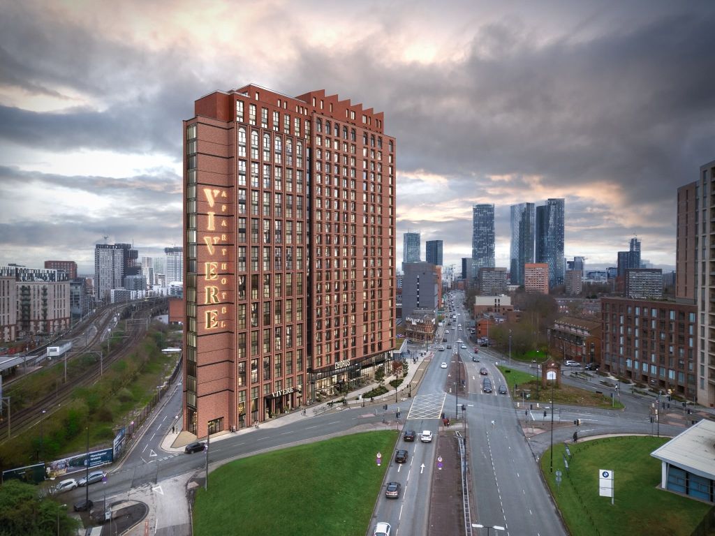
The aim is to start building the first new homes identified in the strategy in 2021, the council said. The plans form part of Rochdale’s wider vision to bring forward thousands of homes in the town centre, including at the Central Retail Park, the canal corridor, and Drake Street.
By all mean build more residential flats and warehouse but build them with consideration of the larger picture and surrounding area. I understand that unfortunately apart from the Roche which is now partially uncovered Rochdale does not have a water front. I would suggest that a future significant improvement plan would be to open the river across the full esplanade, but to include a small weir to hold some water back to enhance the appeal. Now if you take this thought and apply it to Rochdale canal, the existing waterway could be extended in two phases. Firstly to the first basin just after the first bridge and down towards the halfpenny bridge with the existing warehouse being given rear access to their preimises. This could then be extended to the larger basin on the old MFI site with water front dwelling surrounding it and being within walking distance of the town centre. The site is so large that boat moorings with houses in between is quite feasible.
Please consider the larger and better prospect for the future.
By David Brock