

May launch date for Manchester infrastructure map
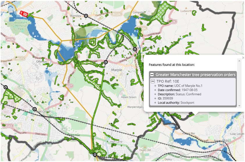
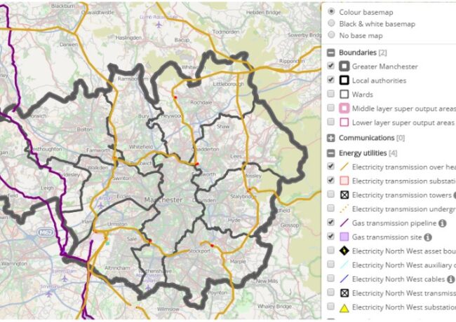
A Greater Manchester infrastructure 'mastermap' is due to become available in May as an online resource for planning officers, planners, developers and members of the public, outlining details such as green spaces, flood risks, heritage assets, transport routes, and communication lines.
New Economy and Salford City Council have been researching and developing the map for the past year on behalf of the Greater Manchester local enterprise partnership infrastructure advisory group. The aim of the map is provide comprehensive information to help users understand the city and its developments areas.
A report ahead of a meeting of the Association of Greater Manchester's housing commission on 15 April gave an overview of the project so far, and showed images of the map in use.
The map has around 50 layers of detail about various infrastructures across Greater Manchester.
The information for the map has been sourced from local authorities, public sector authorities, utilities providers and private sector data holders. The data will be added to throughout the lifetime of the project so that the map is as relevant as possible.
The map will be hosted on the Salford City Council website and will be circulated after the election in May, with training events on how to use it throughout late spring and early summer.
Over the next year partners will be encouraged to use the map and feedback improvements to New Economy. The planning team within the Association of Greater Manchester Authorities is also looking at other uses for the map.
Click any image below to view the map